Sunday, April 17, 2011

Doyles River and Jones Run Part 2- April 17, 2011

Guest-starring Susie An!

Today we set off for an adventure in the Shenandoah National Park with our good friend Susie!  As we got closer to the Skyline Drive, we realized that "Ooops!" Alex had forgotten the National Park Pass.  Hoping that they would somehow be able to look us up, we continued on our way.  When we asked the ranger she told us that no, she couldn't look us up, but luckily, it's National Park Week (April 16 - 24th) and admission is free all week!  After a 30 minute drive, we made it to our trailhead, but we had no idea what would be in store for us.

We knew that with the storms yesterday the waterfalls would be much stronger than the last time we hiked these trails.  We just didn't know how strong.  A lot of the trail had been turned into streams, especially as you walked farther down the mountain.  As soon as we started, we could hear the sound of what we thought was Jones Run Falls, but it was actually a large stream that did not exist the previous time we hiked the trail.  There was no obvious way across without getting very wet.  We looked up, down, and ALL around, and eventually we found fallen trees that could save us!  Alex gingerly walked across a rickety old log which bowed with every step.  Jamie and Susie opted for the butt scoot across a stronger, more stable, but skinnier log.  We made it across without knowing that there would be many more daring crossings to come.

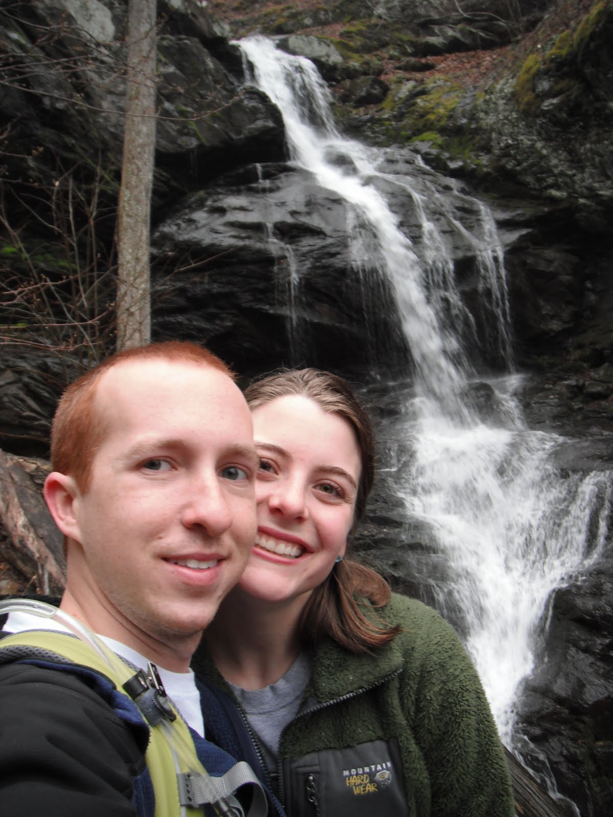
After 20 minutes of puddle hopping, we made it to Jones Run Falls.  It did not look anything like it did last time.  It was HUGE!  We couldn't go anywhere near the spot where we took pictures last time because it was engulfed with flowing water.  We continued on the trail until we ran into another roadblock.  It was more than 40 feet of flowing water with no rocks to jump across! Again, we found an enormous fallen tree that could get us across.  Alex walked with ease to the other side, but Jamie took her sweet time, making sure to be extra safe.  Susie had a different kind of roadblock. Jamie.
The long log crossing!

The next challenge was the hardest of them all.  We had great difficulty passing here last time when the water was much lower.  We had been told by other hikers that they made it across, so we knew it was possible but had no idea how.  After walking down and then up the river, we found yet another tree that could get us across.  This time it was butt scooting for everyone because the tree was rather skinny.  What a funny sight that was.  Because we had to hike a ways back up the river to find this tree, the other side was not very hiker friendly.  In fact, it was basically a cliff, but we somehow managed to make it back to the trail after seeing a SNAKE! Jamie didn't run this time, which was a good thing, because there was nowhere to go.


The rest was a cake walk. Kind of.  Just one more easy log crossing.  The hardest part now was that it was all uphill.  The falls were incredible to look at and so was the green bug we saw! We later learned that it was an evil bug (the Emerald Ash Borer) which had invaded from Asia and was killing all the Ash trees! Oops, we thought he was friendly.

We took the Appalachian Trail back to the parking lot and were happy to be done with a fantastic, daring, long hike.  All those river crossings gave us a workout!
What a difference!
One week ago. Same overlook.


Total Hike Time: 4.33 h
Difficulty: Strenuous

Distance:8.33 miles
Elapsed Time:4:19:53
Avg Speed:1.9 mph
Max Speed:13.2 mph
Avg Pace:31' 12" per mile
Min Altitude:1,628 ft
Max Altitude:2,953 ft

Wednesday, April 13, 2011

South River Falls - April 10, 2011


Our first documented adventure with Dan and Charlotte!


Another foggy start to our day, but interestingly this time when we reached the mountains, we were ABOVE the clouds!  This was a hike that we had done a few times before and loved, so we wanted to share the joy with Dan and Charlotte.  We began by hiking down the fire road (the road which had previously made Jamie very tired going up), so that we could reach the base of the falls.  The falls were beautiful, and if it had been warmer, it would have been nice to wade in the pool at the bottom.  There was a lovely rock near the waterfall that looked great for a picture, so we decided to get a group shot of all of us, using the timer on the camera.  Dan, Charlotte, and I lined up and waited as Alex set up the camera. When it was set, he sprinted towards us to make the 10 second limit.  Unfortunately, the rocks had another idea and Alex went tumbling down.  Luckily, he only had a couple of scrapes. That's the picture the camera took after Alex fell. Look at Jamie's face!

Alex wasn’t injured enough, though, to keep him from exploring more. After we had our fill of the wonderful falls, we climbed up the mountain next to the falls to get a view of it from the top.  It was very slippy and steep but we managed by using all four of our limbs.  We made it to the top of the falls and the view was great.  We then hiked over the the viewing area that was on the trail to give us a different perspective of the falls.  It was quite a different view than in February when it was frozen. 

We then hiked back up the trail towards the Skyline Drive.  The trees still weren’t green yet, but there were more and more hints of spring.  The highlight of the trip.... we didn’t have to tell Dan “horses” once!

horses: verb- a request for the leader of the hiking pack to slow down

Total Hike Time: 1.5 h
Difficulty: Moderate 
Distance:3.68 miles
Elapsed Time:1:25:20
Avg Speed:2.6 mph
Max Speed:5.9 mph
Avg Pace:23' 13" per mile
Min Altitude:1,986 ft
Max Altitude:2,999 ft

Tuesday, April 12, 2011

Doyles River and Jones Run - April 9, 2011


Today was a very foggy day!  The drive to Shenandoah National Park was pretty clear, but as we approached the mountains, we could see clouds sitting on the very top of them.  It was pretty treacherous with the visibility so low, but we made it to the trail head safe and sound.  As we got out of the car, we stepped into the clouds, which we could see moving past us.  Now it was time to start our hike down to the falls of Doyles River and Jones Run.

Doyles River consisted of two water falls by definition (Fun Fact! Falling water must be 14 feet tall to be considered a waterfall.) (one was 63 feet and the other was 28 feet) but even the smaller drops were beautiful.  Walking through the woods with the clouds made us feel like we were in Sleepy Hollow, but luckily we didn’t see any headless horsemen.  The hike was a bit dangerous at times due to the wetness of everything which made the rocks extremely slippery.  (Jamie did quite a bit of yelling at Alex to prevent accidents.) The danger was well worth it because of the wonderful scenery! (says Alex)

After hiking past Doyles River Falls, it was just a few more miles to Jones Run Falls! We weren’t quite sure as we were hiking where the real falls actually started because it seemed that the whole river was steep enough to be considered falls.  But when we got there, we knew it! The falls were amazing!! If it hadn’t rained the day before and if we weren’t in a cloud, we would have been able to get closer, but as usual Jamie made sure we kept a safe distance to make sure we didn’t slip on the wet rocks into the river!
Once we hit Jones Run, the hike switched to uphill, so thank goodness Jamie’s coffee (from the strange 7-11 in Elkton) did the trick.  It was about 1.7 more miles to the Skyline Drive and then 3.5 miles back up the Appalachian trail to our car.  It was pretty cool how the A.T. crossed the Skyline Drive twice on this part of our hike.  The A.T. also crossed through an overlook, which had some great views of the scenery.
From there, it was just a short hike to the parking lot.  It was an awesome experience to do this hike in a cloud but we were happy to be done with it! It was a bit cold and wet! :)

Total Hike Time: 3.5 h 
Difficulty: Moderate to Difficult

Distance:7.97 miles
Elapsed Time:3:28:07
Avg Speed:2.3 mph
Max Speed:10.3 mph
Avg Pace:26' 07" per mile
Min Altitude:1,556 ft
Max Altitude:2,924 ft


Sunday, April 3, 2011

Riprap Trail - April 2, 2011

We set out to hike to Chimney Rock and back, about a 3.4 mile trip.  Then Jamie went crazy and said, "No! Let's hike the whole thing!." We knew our options were the shorter hike to Chimney Rock, or the 10 mile circut that connected to the Appalachian Trail to get us back to the car.  You must know, on previous hikes, it has been a challenge to get Jamie to go just a few miles, however, on this day, Jamie was energized from her tea and packed lots of snacks, so she insisted we take the longer trail.  And oh my was it a great idea!

When we arrived at the trailhead, it was cold, windy, dark, and SNOWING! Yes, snowing in April at 39 degrees.  We were hesitant to get out of the car to start our hike until, in an instant, the sky turned from dark to blue! The weather shifted a lot on the trail;  we would hike for a bit with blue sky, and then in several minutes, it would be frigid and snow/sleeting on us!


We reached Chimney Rock pretty quickly, as it was only 1.7 miles away from the parking lot.  It had a great view of the valley below, and the rocks actually did look like chimneys.  The area was not too large though, and it was VERY windy, so we only stayed for a few minutes before heading on for Jamie's daring adventure.


From there it was downhill, and then downhill, and then a little more downhill.  (Jamie's concern about this is always that it means you'll be going UP at some point).  Thanks to Alex's new iPhone app, we could track that we traveled from 2846 feet to 1695 feet in elevation.  At the bottom of the mountain, we reached a stream that had lots of small falls.  We also had to cross the stream several times, pouncing from rock to rock so that our toes didn't get wet.  Lots of fun!


We saw several gnomes on our hike.  Can you spot them?


The rest of the hike was, as Jamie feared, uphill.  But, haven eaten the breakfast of champions, Jamie and Alex reached the top without too much trouble.  Caffeine can do wonders!!!!!  There were lots of view on the trail of the Shenandoah Valley with the Blue Ridge Mountains in the distance.  Sometimes it was hard to tell what was mountain and what was sky, they were so blue.


After hiking 8.86 miles,according to GPS, or 9.8 miles according to the trail map, we reached out destination!  Prior to this hike, our longest was less than 4 miles.  We blew that out of the water thanks to Jamie's motivation! Here's to a longer hike next week! :)

Total Hike Time: 3.5 h
Difficulty: Moderate to Difficult

Distance:8.86 miles
Elapsed Time:3:13:32
Avg Speed:2.7 mph
Max Speed:10.2 mph
Avg Pace:21' 51" per mile
Min Altitude:1,694 ft
Max Altitude:3,005 ft